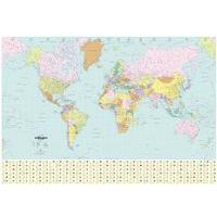
World political map bex
Updated to include south sudan it clearly shows international and internal boundaries as well as major airports seaports railways and time zones a large panel along the bottom provides vital statistics for each country including flag and population with the clear laminate surface its great for use in classrooms for adding annotations this map is 830x1200mm in terms of size and includes south sudan best selling political world map clear and colourful political borders includes airports


.png)